[page 1, page 2, page 3, page 4, page 5, page 6, page 7, page 8]
| The detail of the map found USGS map shown at right shows most of the volcanoes (red dots) of this region together with the boundaries between these plates (where most earthquakes occur.) Most of these volcanoes are pretty close to the seams. One exception to this is Fogo on Cape Verdi Island off the coast of Senegal. There are some nice pictures of the volcano here: http://volcano.und.nodak.edu/vwdocs/volc_images/img_fogo.html | 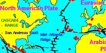 |
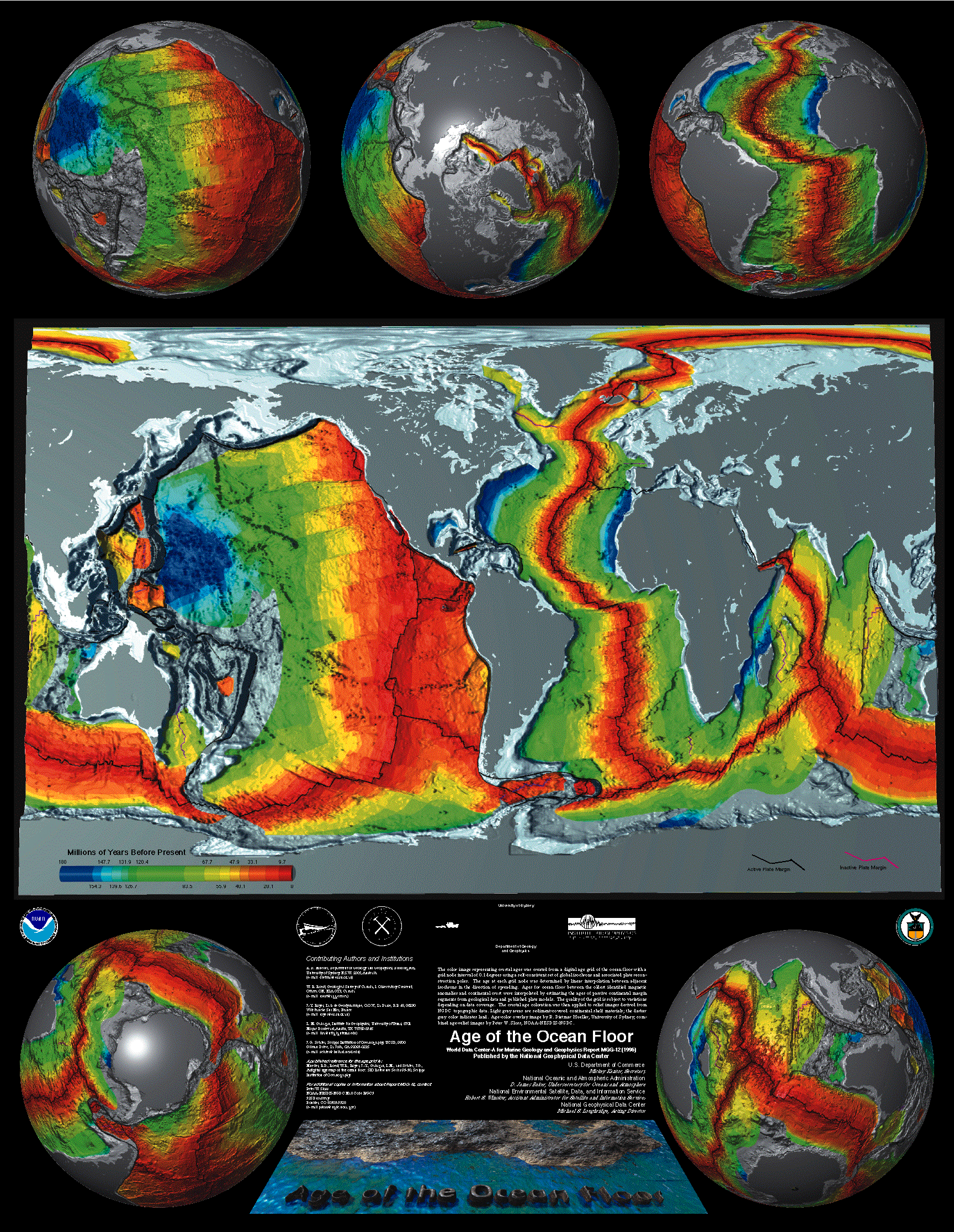
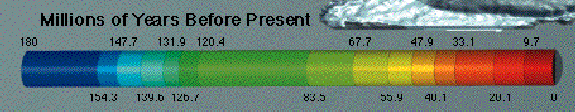
This is because where plates are drifting
apart new crust is made by magma forced up to the surface to create new
crust (mostly sea floor); and where plates are pushed together, especially
underwater, subduction occurs and causes old lithosphere to be recycled
back to the asthenosphere.